


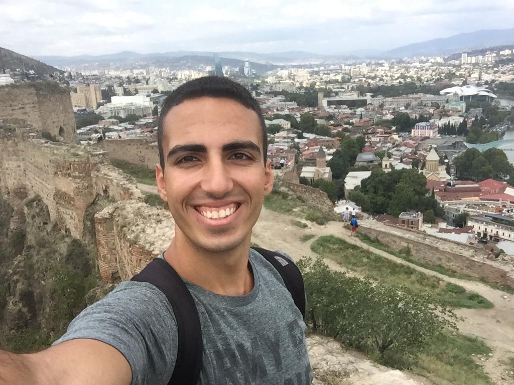
Off-Roading, "Happy Water", and Zero Visibility: the Northeast
- Aaron Schorr
- Feb 15, 2020
- 14 min read
Updated: Aug 9, 2021
I tried to get going at 8 the next morning, only to discover one of my spare gas bottles had leaked into one of the panniers. My departure was thus delayed as I tried to clean my bungee cords and pannier, resulting in me smelling like an fuel truck before I even set off. I rode back across the island and took the return ferry that arrived at 9, with 8 hours of daylight ahead of me and no specific destination. I was going to bypass Hanoi, ride north towards the mountains on the Chinese border, and try to cover as much distance as possible before settling in for the night. I was essentially riding another side of the northern urban triangle, west from Hai Phong along the AH14 highway until turning north before hitting the capital.
Yet Another Google Maps Blunder
This was another morning of stressful riding, slaloming between masses of container trucks making the trip from the port to the city. Stressful as it was, though, it was the fastest riding I had done yet, covering the 200 kilometers to the city of Thái Nguyên in just over three hours, a speed I had previously considered unachievable in Vietnam. There were plenty of traffic policemen out on the road, but they seemed focused on the trucks and not on speeding motorbikes and hardly gave me a second look as I desperately slowed from 90 to 70 after noticing them.
Google Maps tried to take me on a car-only motorway again, forcing me to make a major detour through the city of Thái Nguyên. Exiting the city marked the blessed end of the horrible industrial urban sprawl that had been my scenery on the mainland since driving to Tam Coc nearly a week earlier, and from there it was a straight shot up the QL3 road, following the Cầu River valley into the mountains. It was a wonderful road, wide, smooth, and scenic, reminding me of the roads leading into the Alps in Austria and Germany, only with much more aggressive bus drivers.
The next city was Bắc Kạn, the gateway to the north-eastern mountains. I sat down to have lunch in a very lively restaurant, where a large group of locals were celebrating something with a long series of toasts, marked by chants of "Một, Hai, Ba, dzô!" (Three, two, one, cheers!), which is how Vietnamese toast, which they tend to do a lot. A homestay on the shores of Ba Bể Lake, 2 hours' ride further north, caught my eye, and I decided to push on to there, Bắc Kạn not having anything to offer for the rest of the day.
Walking to the bike, one of the merrymakers approached me and shook my hand as he said something in Vietnamese. I tried telling him I didn't speak his language, but he just kept droning on, his speech slurred from the alcohol and refusing to let go of my hand. The fact that I was responding in English didn't seem to bother him; a woman I assumed was his wife just looked on and laughed, as if this was a normal event (maybe it was?). Just another day in Vietnam.
Welcome Back to the Mountains
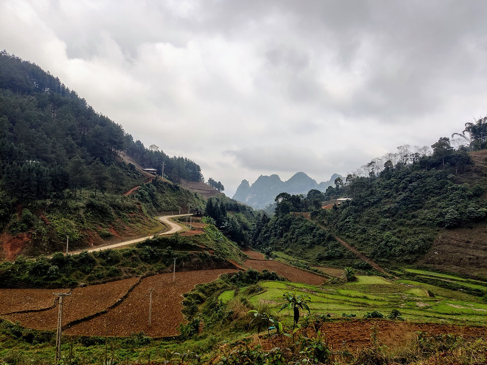
Departing the lovely QL3 for a provincial road, I could have no more doubts I was heading off the beaten path. The road snaked its way across the mountains, the scenery unfortunately mostly hidden by fog, and the villages grew smaller and less frequent the more distance I put between myself and Bắc Kạn. I later learned that Bắc Kạn is the least populated province in Vietnam, with a population of less than 350 thousand, and it sure showed.
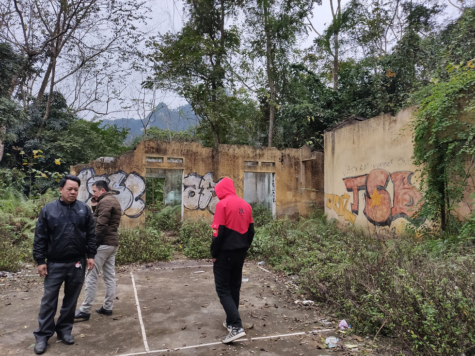
The road descended towards the lake and rapidly deteriorated into a rough unpaved track; my body had had enough of bouncing around at this point and was very happy to arrive in the small lakeside village of Pác Ngòi. I had ridden 378 kilometers in a gross eight hours since the morning, more than any other day in Vietnam and over twice my daily average. After leaving my bags at the homestay, I decided to get back on the bike and use the final remaining hour of daylight to see a bit of the lake. The fog and late hour unfortunately made the scenery a lot less spectacular than the photos I had seen, but I did accidentally discover some abandoned houses in a forest clearing, where my photoshoot was interrupted by some locals who seemed less than happy to see me.
Ominous Signs
The village had no gas station and the closest one was 15 kilometers uphill, so I was glad I had my reserve bottle to bail me out the following morning. I followed the path back to the QL3 and turned north. The temperature had been steadily dropping since crossing the DMZ, but this was the coldest day yet. I had started riding in a t-shirt and hiking pants back in Saigon and gradually added a thermal layer, a two-layer jacket, a scarf, thick socks, and glove liners.
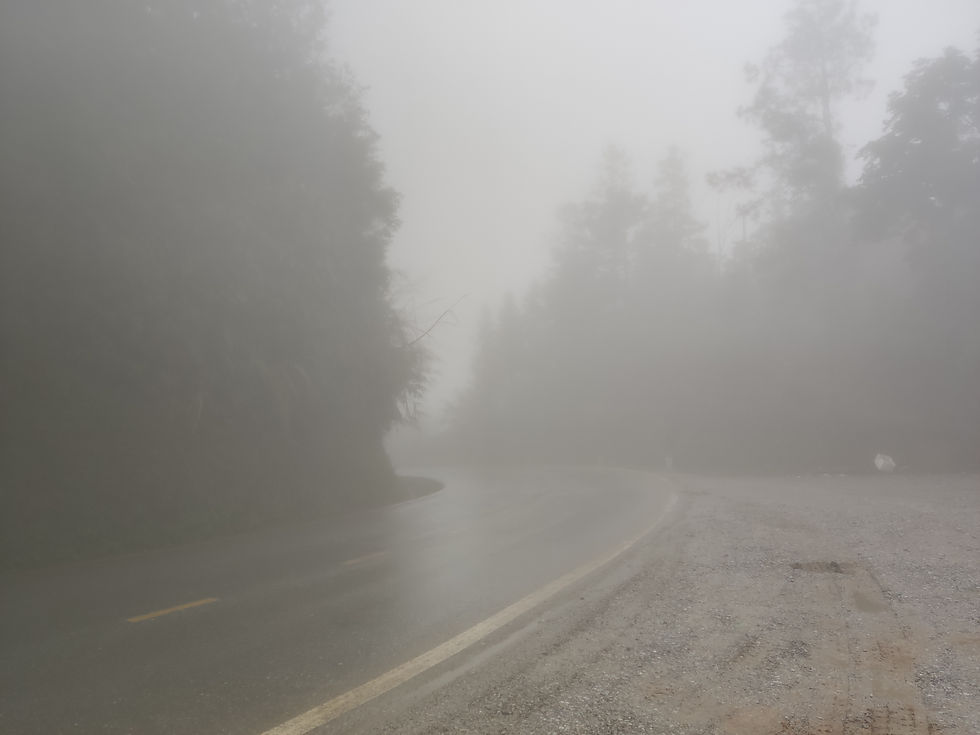
The difference in weather between south and north seems crazy at first, until I saw I was a full 12 degrees of latitude north of where I had started, equivalent to the difference between Tel Aviv and Bucharest, or Miami and Washington, D.C. It was also the foggiest day yet, and the visibility only got progressively worse as I gained altitude on the Gió Pass and rode literally into the clouds. I could see perhaps 15 meters ahead of me, enough to spot the turns in time and avoid traffic in the other direction, some of which was driving or riding without lights.
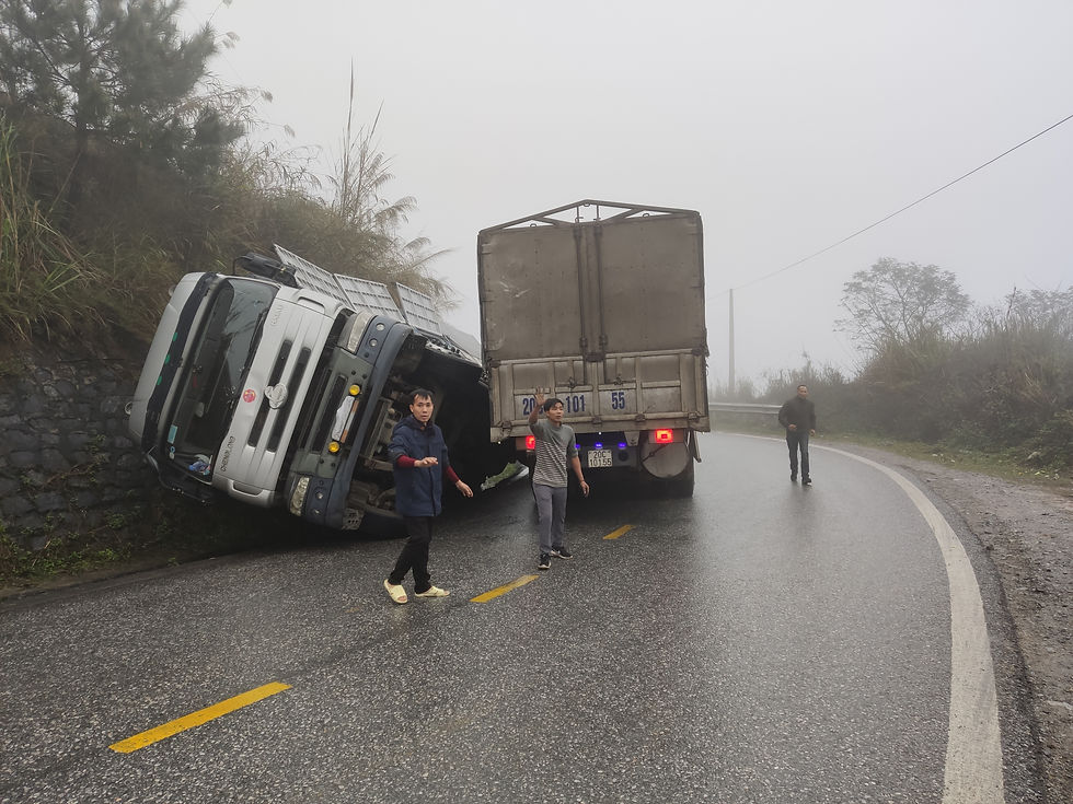
Approaching a turn, I saw the outline of a truck and what appeared to be a container on the side of the road ahead. Drawing closer, I saw that the container was actually a truck that had fallen off the side of the road (thankfully the uphill one) and was resting against the slope nearly on its side. There was quite a crowd gathered to watch as the other truck tried to do... something; the drivers were running around yelling at each other and then at me when I took photos. It felt like quite an ominous sign about the road ahead and made me more cautious about riding in such bad conditions.
The top of the pass was shrouded in thick clouds and visibility was down to 5-10 meters. It was nerve-wracking riding, with no way to see what was coming, both in terms of the turns and the traffic. The air was so damp that I had to pull over every few minutes to wipe my visor of the moisture that kept accumulating and obscuring my vision even further. It felt like extremely high altitude, but the top of the pass wasn't even 700 meters above sea level.
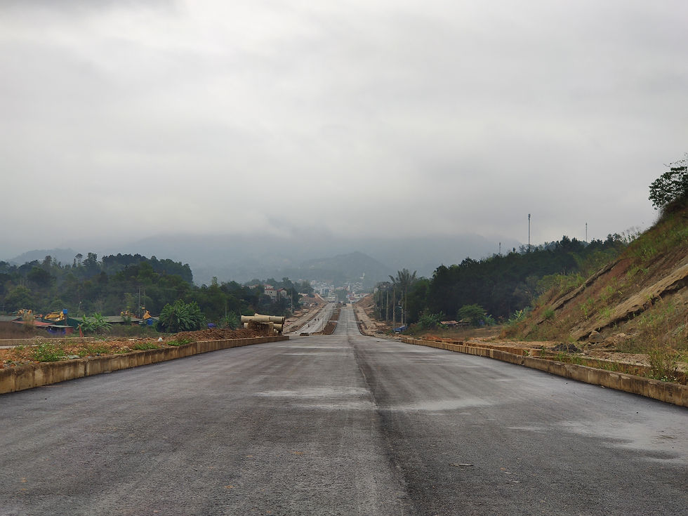
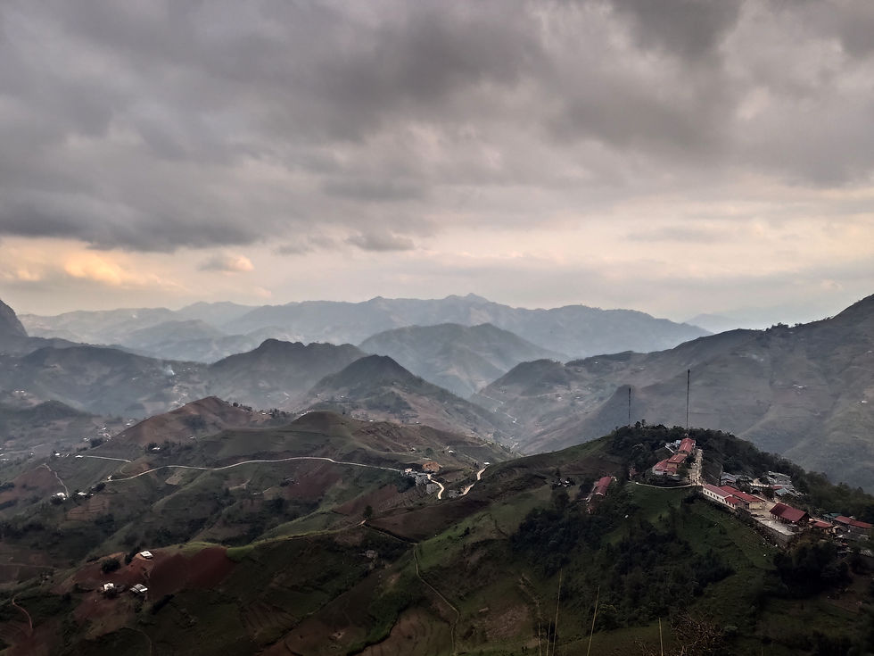
The rest of the way was mercifully at lower elevation below the clouds, but the views were mostly obscured by the fog. I made it to my destination of Cao Bằng around 1, earlier than I had expected. Cao Bằng is the capital of one of Vietnam's northernmost, poorest and least populated provinces, but is actually much bigger and more civilized than I had expected. I thought I was heading to a backwater mountain town, but it looked much like everywhere else in the country, down to the grand boulevard under construction entering the town. It seems like the Vietnamese government has decided every town in the country needs a perfectly straight two-lane boulevard to connect it with the highway, judging by the number of such roads I've seen being built and ridden on in places as far-flung as Buôn Ma Thuột and Phong Nha.
Fairytale Valley
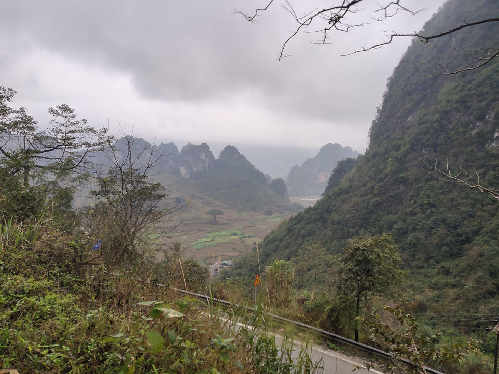
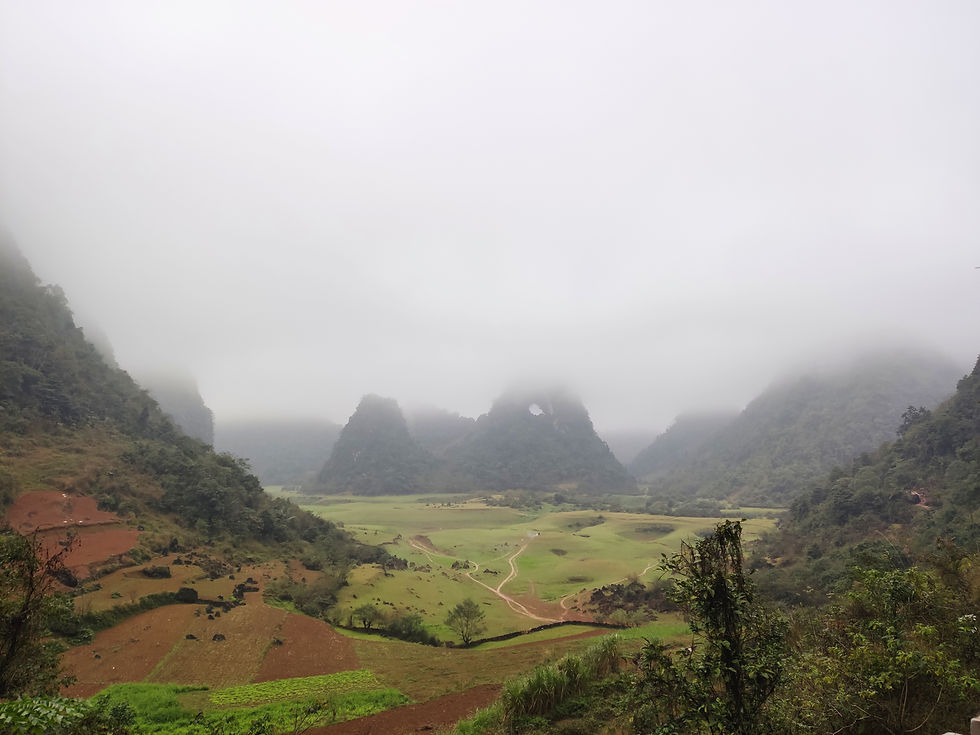
Arriving at my homestay, I asked the owner if he had a recommendation for a place to go. There were some really impressive waterfalls on the Chinese border, but he said I didn't have enough time before dark to go there and come back and suggested I go to a place called Angel Eye Mountain instead. After lunch (rice with all sorts of unidentifiable foods) at a place they had recommended as well, I rode north out of Cao Bằng in a beautiful valley and it seemed the fog was finally dissipating. Crossing the Mã Phục Pass, I finally got my first proper view of the scenery in the north-east, kind of similar to Phong Nha but more alpine.
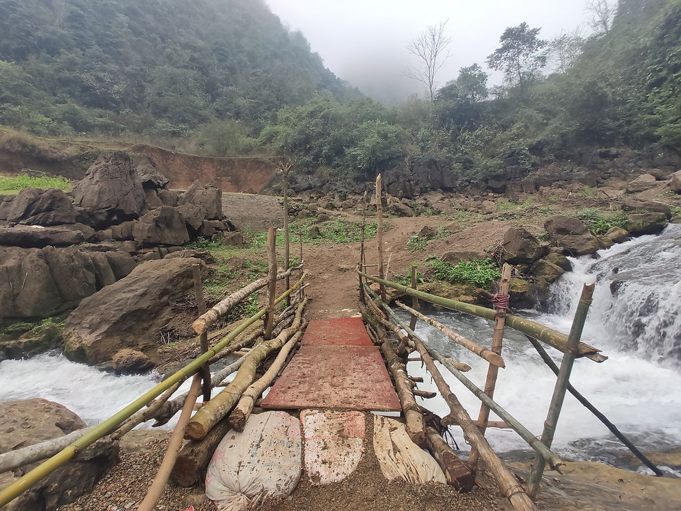
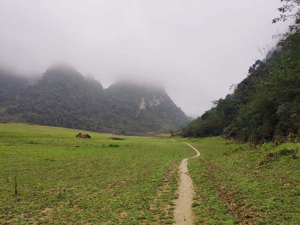
I turned off the highway and rode on a concrete path through fields and rice terraces. It was becoming muddier the further I rode, until it became so steep and muddy I wasn't sure I would be able to make it back, so having learnt from my mistakes I dismounted and decided to walk the rest of the way. Below me was a lush green valley hemmed by steep mountains covered in fog; I followed a rocky path that seemed to head around the valley to try and avoid the mud. I followed the path until it ended and then walked through some fields towards the sound of water. I came across a river cascading from the mountains into the valley below with a rickety bridge crossing it; the other side seemed promising. I ended up in the valley below the fabled Angel Eye Mountain, named for a very strange hole through it near the peak.
The valley was beyond serene; it almost felt like Narnia. There were cows and buffaloes grazing in the grass, with tribal shepherds tending to them. The only sounds were the animals and the wind; the sun was almost peeking through the clouds, enough to make me uncomfortably warm for the first time in recent memory.
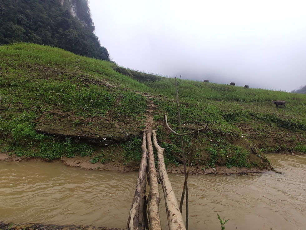
I wanted to cross the river and found an extremely rudimentary bridge across it, three parallel logs laid across the gorge with some branches as a makeshift railing. I sat down on a rock to have some fishy crackers (which turned out to be fishy cookies) and enjoyed the opportunity to take in the nature in silence, as the next few days were going to be spent riding in the mountains. As if to complete the scene straight out of a movie, a horse showed up out of nowhere and galloped away into the distance, with no rider visible.
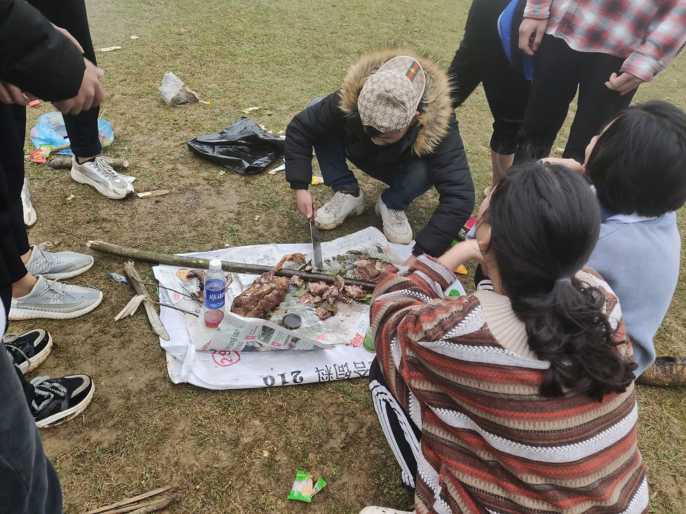
Walking back to the bike through the valley, I saw a group of teenagers on a slight rise who seemed to be having a good time. I approached them to the sound of many "hello!"s and saw they were making some food. They were sat in a circle and a guy in the middle was cutting up a whole bird they had barbequed; I asked what it was and they said vịt, duck. I had previously wondered what young people do for fun in these isolated villages; now I had an answer.
The excursion had resulted in me, my gear, and the bike all getting very muddy and a very tired ride back to Cao Bằng. I gave the bike a thorough wash with a garden hose, had a long shower, and rinsed my muddy things as best as I could, hoping they would dry by morning. I was the only guest at the homestay, and I had a lovely dinner with the host family. Every homestay in Vietnam offers "family dinner", but until now that had meant the guests eating the same food as the family separately from them.
Abandoned Borders
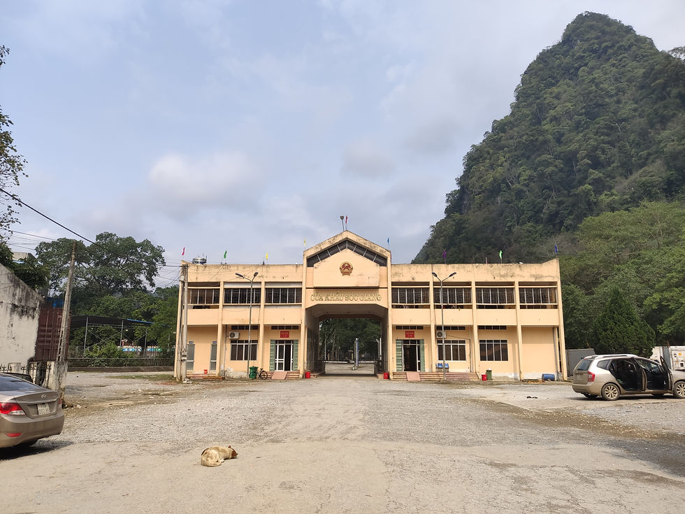
My boots still wet from the previous day's cleaning, I departed Cao Bằng on a provincial road that led through a series of unattractive villages. I had initially left later than usual at nearly 10, having learned that the fog usually gets much better by the afternoon and not planning to rode for very long. Looking for an ATM, I rode through a very dirty market in one of them that almost made me not want to eat anything in the area. The road took me north to the border town of Sóc Giang, where I was supposed to make a left turn. The map said the Chinese town of Pingmengzhen was just down the road, however, so I continued straight ahead towards the border.
I rode through a sort of market, presumably for the many Vietnamese who cross over into China for work, and the road ended it a large customs building. The road led through the building and a gate across it; a few meters past was another gate with a Chinese flag. The entire place was deserted on both sides, the only living thing was a dog sleeping on the road in front of the customs building. I was surprised I could get this far unobstructed; I had been expecting soldiers who would turn me back before I could get close to the actual border, never mind wave at the Chinese border guards, had there been any in sight.
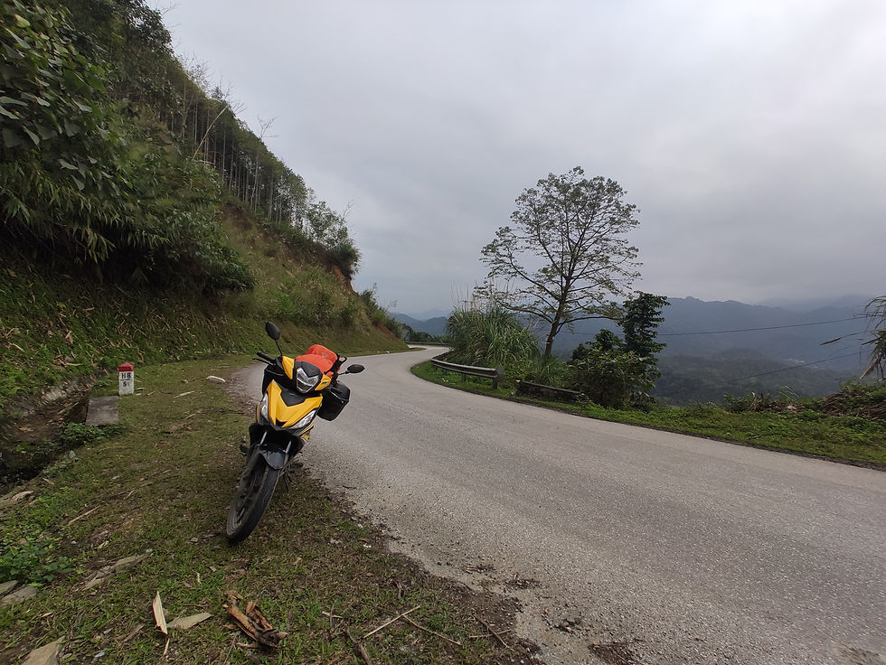
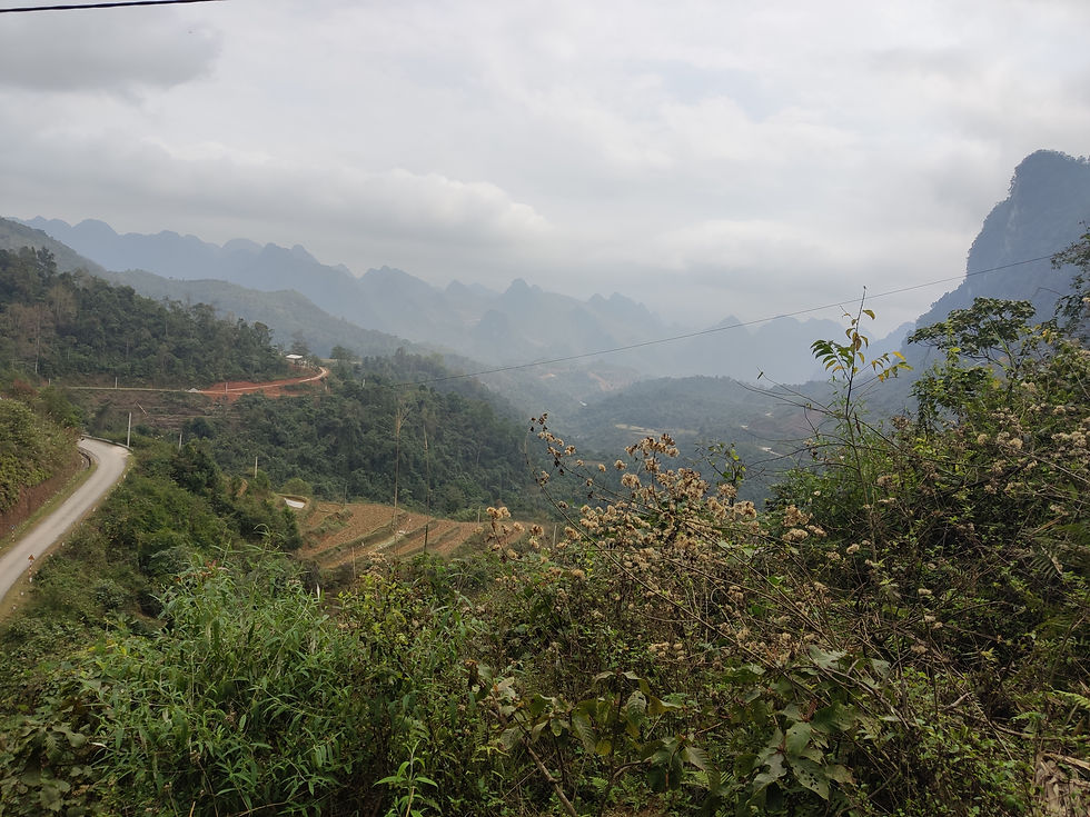
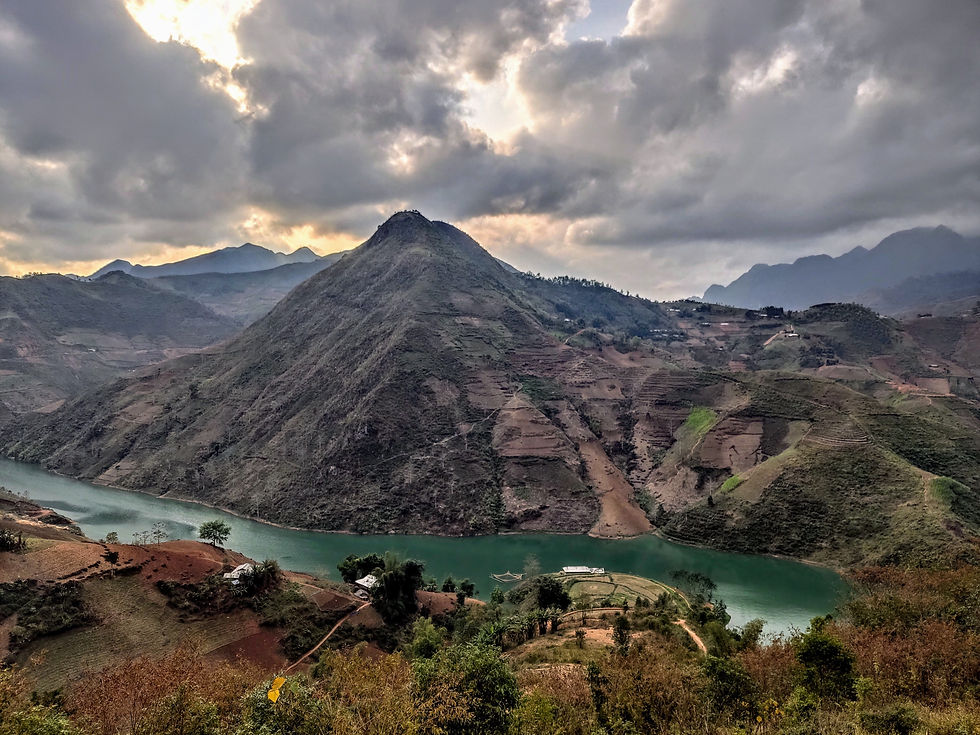
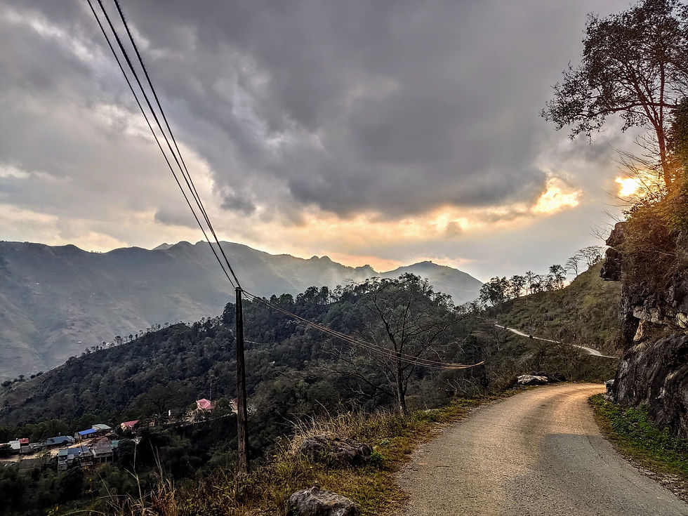
I departed the ghost town and turned onto the QL4C road. QL means Quốc Lộ, or national highway in Vietnamese, and usually signifies a big road with lots of heavy vehicles. Not this far north. The road was narrow and windy, with long streches of 10% grade as it made its way across incredible mountain scenery. Every pass revealed brand-new scenery, each valley different from the previous. The day was much clearer than the previous ones and the sun even came out after a few hours, a lovely sight for sore eyes used to gray skies for the better part of the previous week and a half and all the better to take in the expansive views.
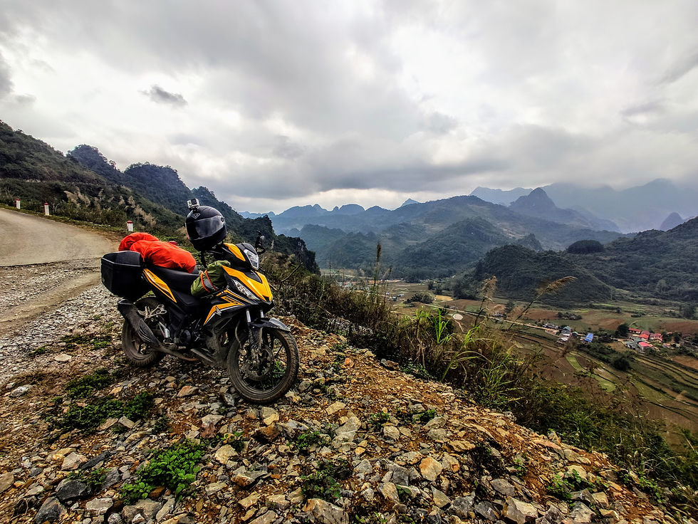
The passes were the most extreme I had ridden on, comparable to high Alpine passes but much tighter and narrower. The most memorable one was the Khâu Cốc Chà, known among foreign riders as "Roller Coaster Pass", and for good reason. No fewer than 18 hairpin turns in quick succession bring you 150 meters down into a long valley which eventually leads to the town of Bảo Lạc, which had been my initial destination for the day.
When Adventurous Becomes Extreme
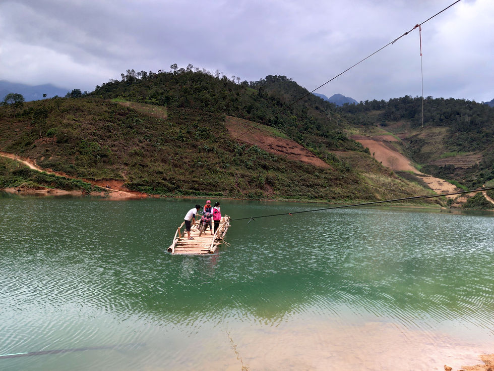
It was only 1:30, so I say down to have some food in a guesthouse restaurant while I considered my options. The friendly owner had tea with me and I asked him if I could still make it to Mèo Vạc that day, which was the next big town to the west. He said I absolutely could and showed me two routes on a big map that was hanging on the wall. I could either stick with the main QL4C road or venture onto the smaller DT217, which was marked as "off-road" on the map. Ordinarily, the main road would have been an easy sell, but he said the smaller road had a "bamboo ferry" to take you across a river towards the end, which sounded totally awesome. I showed him my bike and asked if he thought it could handle the road conditions, to which he said it wouldn't be a problem and should only take about 2 hours, over half an hour less than what Google Maps was predicting. The time was 2:30 by now and sunset was around 5:30, with around another half hour of navigable daylight. Sensing an adventure, I opted for the DT217, despite only finding very partial information about the road online.
The road started off nicely, a smooth ribbon of concrete leading up a scenic valley. The conditions deteriorated at a slow pace, not enough to make me turn back, but becoming worse than any other numbered road I had ridden thus far. The pavement became patchy and then sporadic, the rocky surface becoming both rougher and muddier at the same time as the climbs became much steeper. I had done some serious mountain riding, both further south and that same day, but never before had I had to climb entire hills in first gear, the bike lurching from both the rocks and the hyper-sensitive throttle at such low speeds. The road, if it could even be called that at that point, split every few kilometers and I rode down the wrong prong of the fork multiple times, the map all but useless by then as the other roads weren't marked on it.
On the positive side, I was really far off the tourist trail and the surroundings were incredible. Besides the magnificent views, the road was dotted with little villages inhabited by ethnic minorities who were clearly very Chinese in origin, not surprising considering I was never more than five miles from the border. They wore elaborately decorated colorful clothing, looked like Chinese, and spoke strange dialects that sounded more like Mandarin than Vietnamese. They clearly had an inbreeding problem, though, judging by the number of people with obvious birth defects I saw. I would have loved to learn more about them, but I didn't have time to waste.
The extreme conditions lasted about 20 kilometers and probably took me over an hour to ride, flinching with every rock I hit and praying to every deity in existence to not break down. The last two kilometers can only be described as madness, a nearly 250 meter drop to the river on slippery mud trails often less than a foot wide. Do some simple math and you'll discover that's an average grade of 12.5%, to the point where my engine would rev higher than I normally dared within a second or two of descending in first gear. It was like a maze, too, with different trails leading in different directions and no time to deliberate, as trying to stop would invariably lock up the wheels and possibly end in disaster.
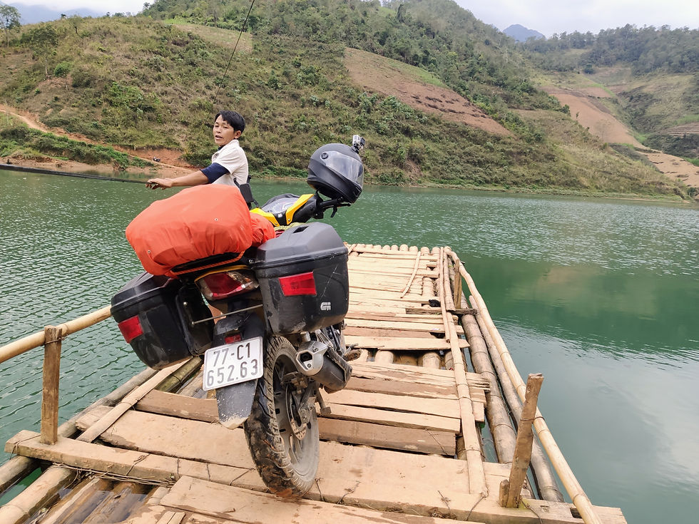
I finally made it to the bamboo ferry, which was just a ramshackle raft pulled across the river by some guy using a power cable strung from one end to the other to propel himself, or in other words: awesome. I got on with two local women who had a bike parked on the other bank and helped the guy pull, since the 50 meter crossing probably would have taken him 10 minutes on his own. My help didn't gain me any points with him, though, and he charged me 50,000 dong ($2.2) after I had read online it was 20,000. Already in a race against the sun, I was in absolutely no mood to argue and coughed up the money.
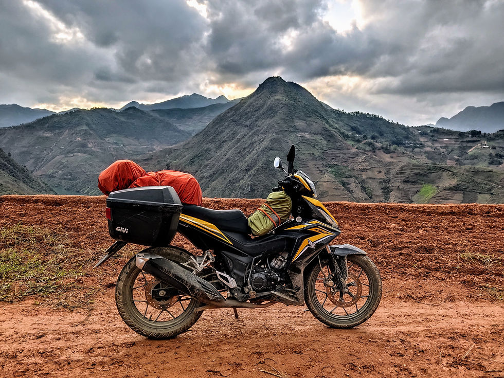
The other bank had another terrible climb back onto the ridge. While not as steep, much of the surface seemed to have been washed away by recent rain, leaving two narrow tracks with a deep channel between them and a steep drop on one side. Precariously trying to balance myself, my back wheel hit a rock and sent me careening towards the edge. Survival instincts kicked in and I leapt off in time, somehow landing on my feet as the bike fell on its side with the front wheel in the air and the rear wheel still spinning in second gear. I briefly summoned superhuman strength and managed to pick the bike up and lift it out of the channel; after catching my breath I carefully made it to the top of the hill where the road blessedly became paved again. By now, I was rapidly running out of both fuel and daylight, with roughly 30 minutes before dark and a similar ETA. I had a spare bottle of fuel on me, but refueling involved having to unfasten my big backpack and then remount it with bungee cords, which probably would have taken around 5 minutes that I didn't want to spend, since night riding in Vietnam is reckless and terrifying. The road followed a ridge, with gorgeous panoramic views of mountains and rivers below it (amazingly, it reminded me most of Iceland), but I only allowed myself one stop for photos. The rest of the time was spent riding as fast as I dared, honking like a local to announce my presence before each turn.
The fuel warning light flashing for roughly 20 kilometers, I made it to the top of the final pass that would take me to Mèo Vạc. I did the same trick from the Dalat-Nha Trang road three weeks earlier and did most of it in neutral; the engine died a couple times in the process but I was fine with that as long as I managed to restart it. I rode into Mèo Vạc and made a beeline for the nearest gas station, where I took on 3.41 liters of gas. My tank holds 3.5 and there was still a gap at the top.
The Happiest Water
My spare gas bottle had burst again on the rough roads; I was so dirty at that point that I didn't even mind the smell of gasoline sticking to me as I tried to clean it up. So much for the thorough cleaning I had given the bike the previous evening; it was muddier than ever, as were my shoes, pants, and gloves. It's moments like these where you really learn to appreciate a hot shower and the instant effect it can have on your general sense of being a civilized human. A typical meal in the northern Vietnamese countryside will include many shots of rượu quốc lủi, or "happy water". This is the local equivalent of the rice wine I had tried further south, typically containing around 40% alcohol, and the locals drink it as if it were really water. The father at my homestay, A Sấn, served us a delicious dinner that included pigeon and kept the shots of happy water coming, each one accompanied by the usual communal chants of "Một, Hai, Ba, dzô!". It was a fantastic way to finish my most insane day yet, and probably the one I'll remember best from this country. The spell was almost broken by an obnoxiously loud group of Israelis blasting Noa Kirel into the night across the street, but exhaustion and earplugs did the trick.


Comments